Earth from space — Incredible images of our planet from above
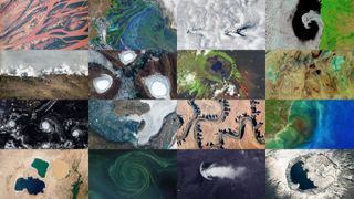
Satellite imagery provides a unique perspective on our planet and can encompass a wide range of different scientific disciplines including climate change, weather, volcanic eruptions and even animal behavior. Every week, we take a bird's eye view of Earth, and see how it affects the people living on it.
See more stunning pictures of Earth
Latest about Earth from space
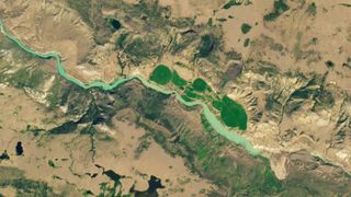
Massive landslide dams Canadian river, trapping endangered fish on the wrong side
By Harry Baker published
Earth from space A recent landslide along the banks of a river in British Columbia completely dammed the waterway, leading to evacuation warnings and potentially dooming an endangered fish population trapped on the wrong side of the debris.
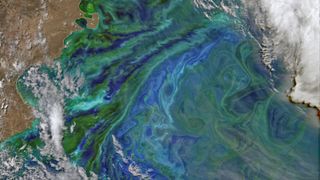
Picturesque plankton paint peculiar patterns in Patagonia
By Harry Baker published
Earth from space This 2014 satellite photo shows a gigantic, multicolor phytoplankton bloom swirling off the coast of Argentina. More recent research has shown that similarly massive algal outbreaks may become less likely in the future thanks to climate change.
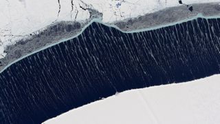
High winds paint puzzling ice streaks across the sea in Antarctica
By Harry Baker published
Earth from space A 2021 satellite photo captured rare, wispy streaks of ice stretching across an ocean channel separating the Ronne Ice Shelf and a patch of multi-year sea ice in Antarctica.
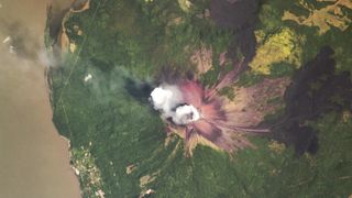
'Smoking terror' volcano that destroyed city 400 years ago burps toxic cloud
By Harry Baker published
Earth from space A 2018 astronaut photo shows Nicaragua's active Momotombo volcano spitting out a cloud of toxic gas and steam just a few years after its latest eruption.
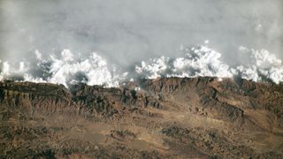
Wall of haze gets trapped behind mountains near 'Throne of Solomon' in Pakistan
By Harry Baker published
Earth from space A 2023 astronaut photo provides a unique perspective of the Sulaiman Mountains in Pakistan, showing how thick clouds of haze get trapped behind the tall peaks.

'River of tea' bleeds into sea after Hurricane Sally smashes into US coast
By Harry Baker published
Earth from space A 2020 satellite photo shows "blackwater" flowing from South Carolina's Winyah Bay after Hurricane Sally made landfall and triggered flash flooding.
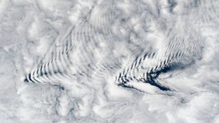
Gravity waves spark pair of perfect cloud ripples above uninhabited islands
By Harry Baker published
Earth from space This 2023 astronaut photo shows a pair of perfectly aligned "wave clouds" rippling above the Crozet Islands in the Southern Ocean. The unusual patterns are the result of changes in temperature caused by gravity waves.
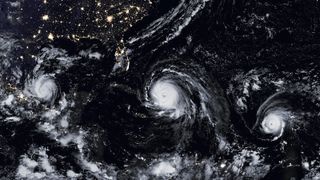
3 hurricanes form a perfect line before smashing into land
By Harry Baker published
Earth from space A 2017 satellite photo captured three hurricanes — Katia, Irma and Jose — in a near-perfect line across "hurricane alley" in the Atlantic Ocean. Interestingly, the storms, which are named alphabetically, appeared to be in the wrong order.
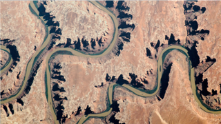
Green River winds through radioactive 'labyrinth of shadows'
By Harry Baker published
Earth from space This 2018 astronaut photo shows a striking section of the Green River as it winds through Utah's "Labyrinth Canyon." The canyon's steep walls cast long shadows that hide many secrets, including caves and abandoned uranium mines.
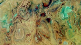
Near-lifeless 'Land of Terror' looks like an alien landscape in the Sahara
By Harry Baker published
Earth from space A 2017 satellite image of the Sahara's Tanezrouft Basin shows the abstract beauty in ancient rock folds and colorful salt flats that have been sculpted in this terrifying region over millions of years.
Sign up for the Live Science daily newsletter now
Get the world’s most fascinating discoveries delivered straight to your inbox.
